Queensland Flash Flooding and Rare Supercells Threaten Australia
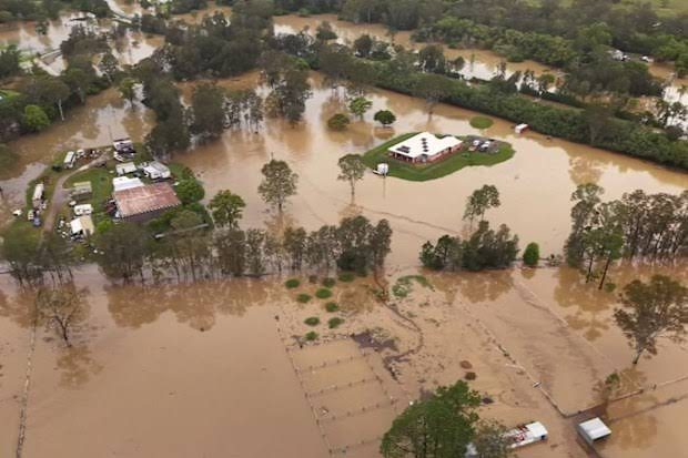
Queensland Flash Flooding: Severe Supercells Hit
Eastern Australia remains under emergency alerts as devastating Queensland flash flooding continues to submerge critical transport corridors and inundate residential properties, driven by severe tropical moisture colliding with rare supercell thunderstorms across populated regions. The sudden atmospheric escalation has overwhelmed drainage networks across Greater Brisbane and the Sunshine Coast, forcing emergency agencies into round-the-clock mobilization.
Record Precipitation Overwhelms Regional Infrastructure
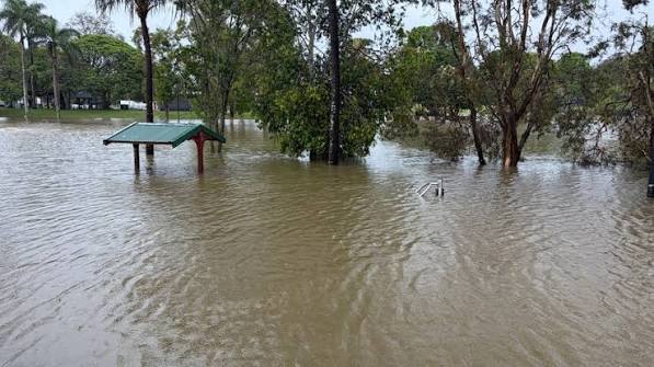
Meteorological registries documented rainfall intensities that surpassed long-term monthly averages within narrow windows. The Caboolture water treatment facility, situated north of Brisbane, logged an astounding 263mm within a 24-hour cycle, including an extraordinary localized cloudburst exceeding 172mm in just three hours. Such extreme precipitation rapidly saturated soil profiles and transformed suburban roads into turbulent waterways.
Inland sectors experienced comparable climate extremes. The regional city of Toowoomba logged its highest October single-day rainfall measurement in nearly three decades. This single event dumped volumes of water equivalent to months of cumulative dry conditions, cutting off access routes, submerging agricultural fields, and destabilizing local electricity grids for thousands of residents.
The Dynamics of Dangerous Supercells Striking Eastern States
Meteorologists note that this volatile system originated from a collision between a moisture-laden tropical air corridor from the north and an aggressive cold front pushing from southern polar regions. This intense thermal confrontation fueled rotational updrafts, giving rise to organized supercell thunderstorms capable of unleashing damaging wind squalls, blinding torrents, and giant hail.
The hazard footprint is expanding well beyond southeastern Queensland. Updated forecasting trajectories indicate the storm front is advancing across northeastern New South Wales and eastern Victoria. The combination of saturated catchments and violent convection creates heightened risks for cascading river rises, mudslides, and sudden surface flash inundations over the entire weekend.
Emergency SES Deployments and Community Safety Measures
The Queensland State Emergency Service (SES) has executed dozens of swift-water extractions, utilizing specialized watercraft to rescue stranded motorists and assist residents trapped in low-lying dwellings. Authorities continue to issue mandatory warnings against attempting to navigate flooded roadways, emphasizing the critical directive: "If it's flooded, forget it."
Recommended civil defense precautions include:
- Avoiding travel through inundated roads, culverts, and causeways, regardless of apparent depth.
- Securing unsecured exterior furniture, machinery, and fixtures prone to strong supercell gusts.
- Monitoring live radar warnings and official updates via verified
- Remaining indoors away from glass windows and power lines during peak lightning and hail strikes.
As atmospheric instability persists across the eastern seaboard, operational vigilance and prompt compliance with emergency directives remain paramount to safeguarding human life until conditions stabilize.

Fadi Q
News writer and editor at Madar24, contributing to the preparation and editing of news and articles and the publication of digital content, with a focus on presenting clear, accurate, and up-to-date information to readers.
All articles by this author