Earliest Polar Vortex Collapse & Weather Chaos
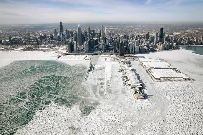
ATMOSPHERIC UNCHARTED TERRITORY: Polar Vortex Weakens in Earliest Stratospheric Collapse on Record, Threatening Winter Weather Chaos
Meteorological agencies and atmospheric research institutions are closely tracking an extraordinary event in the upper atmosphere, as the stratospheric polar vortex collapse has experienced an unprecedented, record-early disruption during the first week of November, raising the prospect of widespread weather volatility across the Northern Hemisphere.
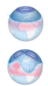
An Unprecedented Phenomenon in Modern Records
As reported by The Telegraph and researchers from the University of Reading, satellite monitoring platforms confirmed a major Sudden Stratospheric Warming (SSW) event. Circumpolar winds located roughly 30 kilometers above the Arctic decelerated sharply and initiated a directional reversal, fracturing the vortex core. Atmospheric scientists emphasize that since systematic satellite records commenced in 1979, a full-scale disruption of this magnitude has never materialized so early in the autumn, during a window when the circulation engine traditionally gains seasonal momentum.
These anomalies have sparked urgent warnings from climate experts across platforms like The Telegraph, Yahoo, the Times Union, and the University of Reading. Because the vortex is disintegrating at this early stage—before the complete formation and maturation of the deep freeze Arctic air reservoir—it disrupts the Jet Stream. This opens the door to early weather chaos that could unleash unusual cold waves and unexpected snowfall toward parts of the northeastern United States (such as New York State) and Europe, or impose dry winter patterns that suppress rainfall.
Analysis from Yahoo and the Times Union examined the downstream consequences for mid-latitude populations. When the polar vortex destabilizes, the barrier trapping freezing air over the Arctic weakens, allowing cold air to spill south toward eastern Canada and the northeastern United States. Forecasters note that while Upstate New York and proximate regional corridors face heightened risks of anomalous cold shots and early wintry precipitation, the overall impact is tempered by early seasonal timing, as Arctic air masses have not yet achieved the extreme temperatures characteristic of deep midwinter months.
Dispatches from The Guardian and the UK Met Office detailed the European ramifications of upper-level wind disruptions. The event is favored to encourage resilient high-pressure blocking over high northern latitudes, redirecting North Atlantic storm tracks away from western Europe. While this setup raises the potential for sharp cold spells driven by continental easterly winds, atmospheric scientists expressed concern that extended dry spells could impede critical autumn reservoir replenishment ahead of the subsequent summer season, testing the limits of modern seasonal forecasting models worldwide.

Fadi Q
News writer and editor at Madar24, contributing to the preparation and editing of news and articles and the publication of digital content, with a focus on presenting clear, accurate, and up-to-date information to readers.
All articles by this authorRelated articles
FAA Ground Stop Disrupts US Flights: Delays and Cancellations Update
Key updates on the nationwide FAA ground stop impacting domestic departures, causing ripple-effect flight cancellations and airport gridlock across the US.
Rising Risks of Social Security Cuts and the Future of Retirement
Millions of retirees confront the growing probability of Social Security cuts over the next decade due to shifting taxable payroll trends, prompting urgent discussions on legislative solvency reforms.
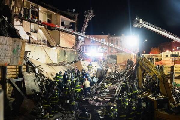
Brooklyn building collapse leads to casualties as rescue continues
Overview of the structural collapse in Flatbush, the mobilization of rescue personnel, survivor operations, and ongoing architectural inquiries.