Historic Polar Vortex Collapse Warns of Severe Early Winter Blast
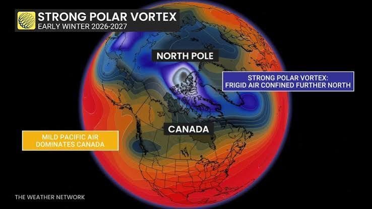
Polar Vortex Weakens to Record Lows: Early Winter Outlook
The polar vortex is on track to plummet to record-weak levels for early November, according to global numerical weather models, signaling a rare and volatile atmospheric disruption ahead of the astronomical winter season. Climate scientists and meteorological observation networks are issuing early warnings as high-altitude stratospheric circulation patterns indicate a major breakdown that will significantly alter surface temperature patterns and hemispheric weather across North America and Europe.

Numerical Models Agree on Stratospheric Disruption
Leading meteorological outlets, including Men's Journal and The Weather Network, emphasize widespread agreement between the European Centre for Medium-Range Weather Forecasts (ECMWF) and the American Global Forecast System (GFS). Both systems show that the zonal winds circulating the Arctic stratosphere are decelerating toward near-zero velocity.
This deceleration acts as a primary precursor to Sudden Stratospheric Warming events. Under normal winter circumstances, a robust polar vortex corrals dense, subfreezing Arctic air tightly around the pole. When this polar reservoir weakens or fractures, the polar jet stream buckles into wide meanders, allowing deep intrusions of frigid Siberian and Arctic air masses to plunge directly into mid-latitude population corridors.
Unseasonable Freezes and Early Winter Blasts
Surface analysis forecasts reveal that this atmospheric unraveling will unleash subzero temperature anomalies far earlier than customary. Major sectors across central and eastern Canada, the upper midwestern United States, and areas of northwestern Europe are projected to face sudden hard frosts and early-season snowfall.
These rapid temperature drops have broad implications for power grids and regional energy infrastructure, forcing utility providers to anticipate heavy early demand for heating fuels. The abrupt onset of intense cold threatens late-harvest agricultural operations and demands heightened readiness across municipal road services.
The Volatile Clash with Active El Niño Dynamics
The current atmospheric destabilization is magnified by the concurrent presence of an active El Niño pattern across the equatorial Pacific. El Niño channels deep plumes of subtropical moisture across North America.
When warm, moisture-laden air masses collide with the descending Arctic air triggered by the collapsing polar vortex, the resulting baroclinic instability fuels intensified low-pressure storm systems. This compound dynamic dramatically raises the probability of complex, heavy winter precipitation events, ranging from freezing rain to widespread blizzards across major transit hubs.
Aviation and Regional Logistics Disruption
According to alerts compiled by Canadian Travel News, airport authorities and international airline carriers are actively drafting contingency plans. Subfreezing runway temperatures, early airframe de-icing protocols, and unpredictable blizzard conditions will likely prompt flight cancellations and airport gridlock throughout late autumn. Travelers are strongly encouraged to track meteorological alerts, verify real-time flight statuses, and prepare for potential supply-chain and transit interruptions as this historic weather pattern unfolds.

Fadi Q
News writer and editor at Madar24, contributing to the preparation and editing of news and articles and the publication of digital content, with a focus on presenting clear, accurate, and up-to-date information to readers.
All articles by this authorRelated articles

أسعار الشوكولاتة في ألمانيا تقلب الموازين بين ليندت وميلكا
An unprecedented market paradox hits retail shelves as premium Lindt bars retail below mass-market Milka, prompting immediate executive consequences.
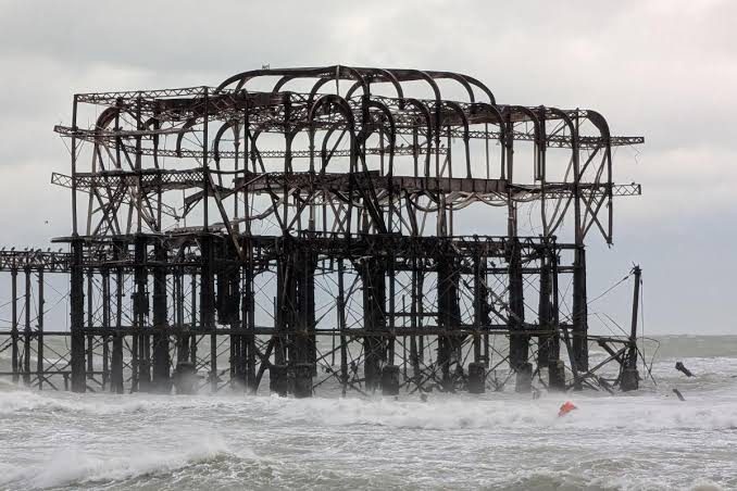
Brighton West Pier Collapse Following Destructive Gales of Storm Austen
High winds and violent waves from Storm Austen trigger structural collapse at the Grade I listed Brighton West Pier along England's southern coastline.